Difference between revisions of "Modul socjo: Wyniki"
From RiversWiki
(→Rozkład typów gmin na obszarze polski/Map of commune types in Poland) |
(→Statystyki zaludnienia / Population statistics) |
||
| Line 1: | Line 1: | ||
==Statystyki zaludnienia / Population statistics== | ==Statystyki zaludnienia / Population statistics== | ||
| − | + | [[Image:commune_types.png|thumb|right]] | |
| + | [[Image:pop_density.png|thumb|left]] | ||
| + | Rozkład typów gmin na obszarze Polski (z prawej)<br> | ||
| + | oraz gęstość zaludnienia w Polsce (z lewej). | ||
| + | |||
| + | |||
| + | |||
| + | |||
| + | |||
| + | |||
| + | Map of commune types in Poland (right)<br> | ||
| + | and population density in Poland (left). | ||
| + | |||
| + | |||
| + | [[Image:low.png|thumb|left]] | ||
| + | [[Image:high.png|thumb|right]] | ||
| + | Ułamki powierzchni obszaru gminy o niskiej (z lewej) lub wysokiej (z prawej) gęstości zaludnienia. | ||
| + | |||
| − | + | ||
| + | Area fraction with low (left) or high (right) population density in communes in Poland. | ||
Revision as of 15:07, 2 July 2008
Statystyki zaludnienia / Population statistics
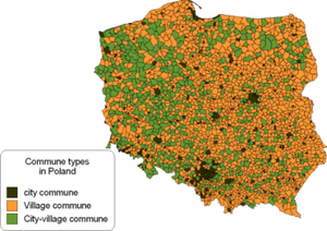
Rozkład typów gmin na obszarze Polski (z prawej)
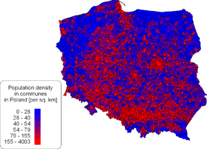
oraz gęstość zaludnienia w Polsce (z lewej).
Map of commune types in Poland (right)
and population density in Poland (left).
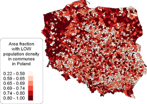
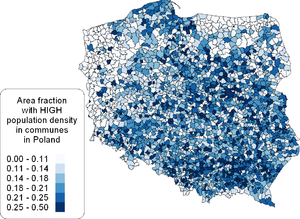
Ułamki powierzchni obszaru gminy o niskiej (z lewej) lub wysokiej (z prawej) gęstości zaludnienia.
Area fraction with low (left) or high (right) population density in communes in Poland.


